|
| By:
|
Rating:  |
Date of Hike: Saturday, November 2, 2019 |
The marble yard is all sorts of fun. We spent over an hour just scrambling around and climbing on the boulders of various sizes.
The "helicopter pad" that is the ultimate goal of the optional 3 mile out and back is a bit overgrown so the views are not exactly as pictured in the desciption above. Still a pleasant hike all around though.
|
|
| By:
|
Rating:  |
Date of Hike: Saturday, April 20, 2019 |
| What a great hike! The loop is well worth the effort, thanks to a combination of scenery and relative solitude in the early season. The extension to the AT is clearly marked and the choice can be made at the junction. All trails are clearly marked and the forest floor has little mud and standing water, even at this time. Highly recommended.
|
|
| By:
Jonny E
|
Rating: |
Date of Hike: Thursday, April 18, 2019 |
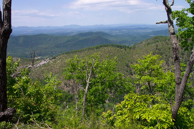
| Fun and pretty hike. After heavy rain, one section of the Belfast Trail adjacent to the Marbleyard was overrunning with water--a bit slick to traverse a steep upward section...probably easier to stay in the Marbleyard then move back to Belfast trail after the first main pitch. There are a few entrance/exit point between Belfast Trail and the large boulder field. The last one is about 1/2-2/3 way up the boulder field. The views along the AT section were especially nice in early spring--lmillions of little green specks just leaving off, big views to the hollow/valley. The turn-off the AT to the helicopter pad is fairly easy to miss/not particularly distinct---a bit of shale packed down in a ~3ft clearing (as indicated in the photo on hiking upward). AT eventually intersects Piney Ridge Trail after another ~1mi on the AT. Some options to make a massive loop there.
|
|
| By:
hopeful
|
Rating: |
Date of Hike: Tuesday, April 9, 2019 |
| I'm wondering if they have rerouted the Gunter Ridge trail. When we got to the top, the trail going up and to the left disappeared after a few feet. However, there was a trail that went kind of straight ahead and down. We decided to follow that one a little bit to see where it went, and it turned out to be the right one. It looks like it now goes around the mountain instead of up it, and the trail seemed to be well maintained. Also, had I not been with someone who had been there before I don't think I would have understood that the actual trail goes beside the rockpile instead of over it. That was a little difficult to see as well since there didn't appear to be any trail markings. The trail beside the rockpile was very pretty going up a stream. Yes, climb on the rockpile, but be sure not to miss the trail beside it.
|
|
| By:
|
Rating:  |
Date of Hike: Thursday, February 14, 2019 |
We did things a bit different to avoid the tick-fest on Gunter Ridge Trail but still do some semblance of a loop. We dropped a car at the Marbleyard parking lot and drove up to the Sulfur Ridge trail head (N37.56424° W79.45423°). This is NOT the same as the Sulfur Springs trail head which you'd pass enroute to our starting point. There is no designated parking at Sulfur Ridge but ample room on the south side of Petite's Gap Road for a couple of cars. The trail is not well-maintained (a few blowdowns) but it pleasant and passable.
The hike involved 1.2 miles on the Sulfur Ridge trail, then 0.9 miles on the AT(northbound) to 5-Points, 1.2 miles on Sulfur Springs Trail (northbound) to the Helicopter Pad (no views per se), another 1.1 miles on the AT and finally to 2.9 miles on the Belfast Trail back to the Marbleyard parking lot. 7.3 miles, 1,000' ascent, 2,200' descent and you pass the Marbleyard on your right on the way down. The Marbleyard itself is pretty amazing.
A pretty easy hike until you approach the Marbleyard where the Belfast Trail becomes pretty steep and rocky. I'd avoid doing this hike in any configuration after a rain as the trail could become very slick. I'd also avoid Gunter Ridge unless you have an open-ended Doxycycline prescription.
All in all, a good hike but the descent down the Belfast Trail is very slow and rugged. On paper, 2-star difficulty but the rocky descent probably bumps the difficulty to 3 stars.
|
|
| By:
|
Rating: |
Date of Hike: Saturday, November 3, 2018 |
| I hiked the 8-mile version on a beautiful fall day with some friends from Central Virginia Trailblazers. We had fun playing in the marbleyard and enjoyed the limited but nice views along the Gunter Ridge Trail, which is not as well traveled. (Wear long pants and avoid doing this in the summer!) We ran into a ranger near the end of the hike, and he was very impressed that we did the full loop (as opposed to just hiking to the marbleyard and back). We had no trouble parking, but by the time we left, lots of cars were parked along the shoulder on Petites Gap Road. After the hike, we couldn't resist checking out "Dinosaur Kingdom II", which was hilariously bad - don't pass this by! Then we had a great dinner at Pink Cadillac Diner before heading home.
|
|
| By:
Adam Q
|
Rating: |
Date of Hike: Saturday, August 18, 2018 |
| Hiked the Marbleyard taking the Belfast Trail (Blue) to the marble yard. The trail was in good condition, and then took the trail up the steep path along the marble yard to the fork of the Gunter Ridge Trail (red). The path after the marble yard is less maintained and we had to go around a fallen tree at one point. Camped at the fork along the AT and it is good to note that there is no water sources along this hike except for the two streams close to the trail head. We hiked to the two cameras at the end of the AT trail shown on the map and we did not see the helipad. Another group informed us that they did not really find anything worth seeing. We hiked the Gunter Ridge Trail (red) back and it was not maintained for a good amount of the trail. Walked through a lot of brush and spiders. There was a stream right before the trail joins the Glenwood Horse Trail (GHT). If I knew the trail was not maintained I would have just gone back the BT instead, but it was a journey to help appreciate what a maintained trail is like.
|
|
| By:
|
Rating: |
Date of Hike: Saturday, July 15, 2017 |
| This is a very unique hike that is loads of fun. I have done it three times and each time you get a different experience, which is what makes this hike so great. Definitely challenging - I do not recommend this hike if you are just starting to get into shape. Lots of climbing, jumping, and crawling up rocks and boulders. Make sure to wear sturdy shoes that have good ankle support and traction, but also aren't too clunky - I wore Nike running shoes and found them more functional for this hike than boots. Also, it can be kind of hot and miserable if you go in the middle of the summer because the rock scramble lacks shade and the rocks radiate a lot of heat back during the day. But overall, this hike is an essential if you live in Virginia and I definitely recommend it.
|
|
| By:
Lisa & Chris
|
Rating: |
Date of Hike: Saturday, July 8, 2017 |
| Devil's Marbleyard was awesome and is definitely the highlight of the hike. Beautiful views and climbing on the rocks is a lot of fun. I wish we'd read the reviews beforehand about the helicopter pad being overgrown- we walked up there and assumed we were in the wrong spot so went further along the AT before we realized that must have been it when we started dipping below the tree line again. It was hard to get any view at all but we at least found a shaded mossy pad to eat our lunch, and as the previous reviewer said, the workout made it worth it. We ended up just hiking back down the Belfast Trail instead of the horse trail so we could get the view from Devil's Marbleyard again on the way down.
|
|
| By:
Lexi Meadows
|
Rating: |
Date of Hike: Saturday, March 25, 2017 |
Loved Devil's Marble Yard. Hiked past it to the Helicopter Pad. Completely missed it according to the site description here and had to turn around and hike back. Finally found it. It was confirmed by a New Jersey hiker with an app on his phone that showed exact location. The area may have been open years ago but has now grown up and the view was not good at all. Completely disappointing but at least we got the exercise!
Came back to the Yard and climbed around on the rocks for an hour or two. Better mobility if you can take your pack off. Heard a bunch of sirens and when we came down out of the yard a boy scout had fallen and was hurt. Shout out for Rockbridge County Sherriff's office and Glasgow Volunteer Fire Dept. Those guys hiked in with all that equipment and I know it wasn't easy.
We arrived at 8:30 am and parking lot was already full as well as some parking on the side of the road. Trail is busy to the yard and again when it joins the AT.
|
|
| By:
Mike H
|
Rating: |
Date of Hike: Saturday, March 11, 2017 |
| First and foremost: the boulder field (or "marbleyard") is spectacular. The hike from the parking lot to the marbleyard is about 1.5 miles, and it is a gradual uphill on a wide and easy to follow trail. There are a lot of rocks that could turn ankles, but it's downhill from a boulder field so that should be a given. Once you reach the marbleyard, you could easily spend several hours rock-hopping and climbing around in it (which I did) make sure you factor that into your plans if you intend to do the full hike as described. It should be noted that safety is of paramount importance - the boulders weigh many, many tons, but could still become dislodged and ruin your day and/or life. After the marbleyard though, the hike really fails to impress. I attempted the 3 mile out and back along the AT, but I got horribly lost and never found any 360 degree panoramas. I think I found the Helicopter Pad, but the view was not as advertised. Due to my unsuccessful AT adventure, I was unable to hike the Gunter Ridge and and Glenwood Horse Trail portions of the circuit and had to return down the Belfast Trail that leads up to the marbleyard. I attempted the Gunter Ridge trail, but there are no markings and I did not have time to figure out where to go. Overall, this hike is worth it just for the boulder field though.
|
|
| By:
|
Rating: |
Date of Hike: Monday, October 24, 2016 |
| This is one of my favorite hikes ever! The hike to the boulders is about a 1 1/2 miles, it's totally worth it. Climbing the boulders is a blast, I did one section, my daughter and friend did all 3! The views were amazing even from the first climb. I was worried about coming down, because I wasn't aware of a steep hill to the left of the boulders (coming down) that is much safer than coming down the boulders. This is definatelly a hike I want to do again! There are also great camping sites at the beginning of the hike at the old boy scout camp.
|
|
| By:
|
Rating: |
Date of Hike: Monday, October 17, 2016 |
| Used this loop as a backpack/overnight trip, 10/17 through 10/18/16. Following route in direction suggested is a good idea, since going down the blue/Belfast trail (especially with a backpack) is not advised due to loose rock & steep step-downs. The campsite at the Gunter/Belfast trails junction is without water at this time of the year, as is the site at the junction of the AT. Both are in saddles. Closest water to first mentioned campsite is 1/2 mi back toward Marbleyard, in ravine south of trail. On the Gunter Ridge trail, we counted 17 switchbacks, not including the slight one at the top. The GLT is marked with standard rectangular orange blazes, except at the "arrow and orange blazes" sign this was our least favorite portion, but at least the forest road was shaded.
|
|
| By:
Martha
|
Rating: |
Date of Hike: Wednesday, June 1, 2016 |
This was definitely the strenuous hike it was advertised to be. The sign is a little misleading as it states 1 mile from where you can park, must be "as the crow flies" but it's more like 1 1/2. I'm turning 59 this year and not in the best of shape so I hit the proverbial "wall" around .85 of a mile up. I managed to tough it out and was rewarded with a spectacular site! This is one memory (one and done) that I will treasure having climbed it with my daughter, Sarah.
If you hike this one, make sure to really absorb your surroundings. It is Mother Nature at her best!
|
|
| By:
Matt E
|
Rating: |
Date of Hike: Sunday, April 17, 2016 |
| Hiked the 8 mile loop yesterday. Would have preferred the 11 mile version but we were being mindful of an ankle that was already starting to hurt. The trail up to the Marbleyard is a good way to get the blood flowing but not overly challenging. Scaling the boulder field is a lot of fun but we chose not to climb all the way to the top as we had many more miles ahead (at this point still planned to do 11 miles). The Belfast and Gunter Ridge Trail intersection is well signed and the Gunter Ridge trail was easy to pick up. The Gunter Ridge trail is already a bit overgrown, and I definitely recommend pants and tick checks. It was easy to follow, though. The Glenwood Horse Trail was a pleasant finish to the day. Overall it was a great hike but without some care the Gunter Ridge Trail seems like it would be bother mid summer. One plus is that after we passed the Marbleyard, we did not see any other hikers until we returned to the Belfast trail from the GHT.
|
|
| By:
Chris C
|
Rating: |
Date of Hike: Saturday, August 1, 2015 |
| The Devil's Marbleyard is really quite spectacular. I've seen many rockfalls in hiking in the mid-Atlantic, but never one with boulders of this size and extent. It is a bit treacherous to cross but is just amazing. A helpful hint: if you want to get to the top of the yard there is a rough trail just to the east of the rocks (on the right looking up) where you can make it up without undue risk to life and limb. The view from near the top is worth it. The Gunter Ridge portion of the trail was not quite as presented here. Maybe a few years ago the views were spectacular, but now things have grown back and you only get occasional glimpses of views through the low trees. Maybe in winter things would be better. The trail was lined with ripe huckleberries though. They were abundant and delicious.
|
|
| By:
Wandering Virgnia
|
Rating: |
Date of Hike: Wednesday, February 4, 2015 |
| I hiked this loop in February after first doing the Sulphur Springs/A.T. loop. I did not veer off to Devil's Marbleyard, and am commenting because this is the 2nd time I've hiked the Gunter Ridge Trail. The first was in October. Gunter Ridge appears to be a trail that would be seriously overgrown in Summer, but in late Fall and in Winter, it was in fine shape. That said, I think it is my least favorite trail in the JRF Wilderness. Check out all the other accesses first, or use the Gunter Ridge Trail as the back end of a loop.
http://pathfollower.blogspot.com/
|
|
| By:
Carl
|
Rating: |
Date of Hike: Saturday, November 15, 2014 |
| Hiked from parking area up the Belfast trail to the top and spent the night in the camp site at the intersection with the Gunter Ridge trail. Took a group of Scouts and though this is only 2 miles, parts can be very strenuous when carrying a backpack. Leaves were off the trees and made for great views but the rocky trail can be slippery from all the loose leaves. A short but strenuous hike that was a good shakedown trek for Scouts being introduced to backpacking. Campsite had plenty of room for 6 tents and a small fire ring.
|
|
| By:
ChrisN
|
Rating: |
Date of Hike: Saturday, October 4, 2014 |
| My wife and I hiked the loop in a counter-clockwise direction because I was afraid that the Gunter Ridge trail was grown over and we wouldn't be able to find it from the campsite. The trail was a little grown over, but overall in nice shape. There's a new sign from the Glenwood Horse Trail to the start of the Gunter Ridge trail which was helpful. We didn't see anyone until we began our descent on the Belfast Trail. I had hiked this five years ago and was amazed by the views on either side of the ridge line while on the Gunter Ridge trail. Five years of growth have impeded the views somewhat, but they were still beautiful. Climbing down the Belfast trail was a bit of a rock scramble. In hindsight it probably would have been easier doing the loop counter-clockwise. Overall it was a great hike. A lot of people were climbing up the marbleyard and also there wasn't much solitude on the Belfast Trail, but my wife loved it and I'd recommend it to anyone. It took about 6 hours with 1/2 hour for lunch.
|
|
| By:
Keith C.
|
Rating: |
Date of Hike: Saturday, August 23, 2014 |
| Took a small group of Boy Scouts. Camped at old Camp Powhatan, then hiked the next morning. They loved the Marble Yard. From there we continued up the Belfast Trail, but based on the info reported below about conditions on the Gunter Ridge Trail, we made a different loop. We took the spur trail over to the Appalachian Trail, turned right, then in a few miles, right again on the Sulfur Spring Trail. (Actually we stayed on the AT for about ten minutes past the Sulphur Spring Trail to visit Marble Spring, then doubled back.) After a few more miles Sulphur Spring Trail takes you to Petite's Gap Rd, then turn right and about 1.5 miles back to the parking area. The Sulphur Spring trail is an old road bed so easy to hike and easy to follow with no intersecting trails. It is blazed blue, and a wooden sign on the AT points the way.
|
|
| By:
|
Rating:  |
Date of Hike: Wednesday, August 6, 2014 |
| This was (note past tense) one of my favorite hikes in the region. I've been to the marbleyard 5 or 6 times and finally convinced the family to go with me, but I now need to send a warning to future hikers. Today, we experienced our first rock fall at the marbleyard. A good sized boulder (about the size of a refrigerator) about 100 feet uphill from our position partway up the first ascent came loose and tumbled about 10 or 15 feet. It wasn't initially apparent that it would stop and regardless would have been a dangerous situation for anyone in the vicinity. Fortunately, no other hikers were climbing the marbleyard at the time and we were able to move safely to the side of the field. This was on 8/6/2014 at about 9:45 AM. I'm curious if anyone else has experienced a rock slide at the marbleyard. This was a first for me and I'm hesitant to return.
|
|
| By:
|
Rating: |
Date of Hike: Sunday, July 20, 2014 |
Overall this hike was decent, but I'm not sure I'd do it again. The boulder field was FANTASTIC, hands down. It is the sole reason I'd do this hike again. There are no trees growing where the huge boulders are, so the sun illuminates them and makes them look that much more brilliant. Boulder hopping was easier and more fun than I anticipated. I hiked it solo and wished I had someone to take a picture of me in front of the boulder field for scale. My picture of the boulders themselves just doesn't do justice to their size.
I decided to do the long version of this hike and met up with the AT, and then followed the hiking directions to the 'helicopter pad,' all the while very excited for the 360 view. Found the spot and there was NO view! All of the trees/plant life seem to have fully recovered from the lightning strike fire years ago, and completely obstructed any view there was to be had. I was totally bummed. But, hey, Nature prevails. Got to appreciate the forest's recovery.br>
I attempted to follow the Gunter Ridge Trail, but I could not track the trail. It was completely overgrown and after doubling back two or three times, decided it wasn't worth getting lost over. It appears that this trail is not maintained in any way, shape, or form. I turned around and went down the Belfast Trail, past the boulders, along the same path that I went up. It was pretty rough on the knees, as the slope is steep. I would definitely not attempt to hike down the Belfast Trail way in rain or if the rocks were slippery. Fortunately I had my hiking poles.br>
Most of this hike is very rocky - you will hike on little rocks, medium rocks, and big huge rocks. I would not try this hike in running shoes or wearing anything but rugged hiking boots. The bottoms of my feet are sore from teetering on and hopping from rock to rock.
|
|
| By:
bikepoet
|
Rating: |
Date of Hike: Saturday, October 5, 2013 |
| This was my first time back to the Marble Yard since 2009. When I was there in 2009, apparently it was not too long after a fire had ravaged the area at the top of the boulder field. So, this time, the terrain looked different and somewhat unfamiliar. I wanted to take a group there that had never been to the Marble Yard, so the intent of our hike was just to go to the boulder field, up, and come back. One of these days, I would like to do the complete loop.
Getting to the parking area: I definitely suggest taking a route from the west since Petite Gap's Road from the Marble Yard to the BRP is a narrow gravel road. The route coming from the west is a paved road. On a nice weather day in October, I expected the parking area to be full, and it was. There were many cars parked on the north side of the road. I found a relatively safe area to the west of the parking area so I could park my car completely off the road. There were a few cars with their tires on the road, and I told my companions that they might get towed. I don't think they did this time, though.
The hike to the boulder field: there are a few easy creek crossings that might be more difficult during the rainy season, but they were no problem for even those in my group with tennis shoes. The hike steadily increased upwards and got more rocky, but since I knew the base of the Marble Yard "sneaks up" on you, I got to see the reaction to the people in my group that had never seen the boulders. It's quite a priceless look when you see someone see the boulders for the first time, so that's a good time to video someone if you can catch them. The hike to the base took about 45 minutes from the road.
The hike up the boulder field: this is where it gets interesting. There are so many different ways to get up the rocks, many easier than others, and many much more dangerous than others. I scraped my shin on a shifting rock, so that was slightly painful. But just be aware that getting up the rocks will put a lot of stress on your muscles and joints. I remember this being easier four years ago! Be sure to bring sunscreen even during the cooler months because there isn't any shade out there on the rocks. The trip up took around 2 houlrs, I think. I didn't time the hike since we weren't going on distance.
At the top of the boulder field: we brought some lunch and snacks and decided to eat, but it was almost unbearable because of the amount of stink bugs this time of the year. The area at the top was definitely not as enjoyable as I remember. Going when the leaves are off the trees might give a better view.
Getting back: I wanted to boulder back down the rocks, but the rest in my group wanted to take the Belfast trail back, so we ventured south from the top of the boulder field over what appeared to be a trodden path towards the trail. If you want to do this, just keep heading downwards to the valley and you will eventually hit the Belfast trail. From there, it's about 15 minutes to the base of the boulder field and 30-45 minutes back out.
|
|
| By:
Keith C.
|
Rating: |
Date of Hike: Friday, September 6, 2013 |
| I hiked up to the Marbleyard then completed the 8.3 mile loop hike back to the old camp Powhatan site and camped there for the night. Overall very enjoyable. I will certainly be going back. I saw one other group at the marbleyard, and a young couple came into camp Powhatan Saturday morning to hunt squirrels, but otherwise I had the place to myself. The Gunter Ridge trail in the area that burned is getting rather over grown with quite a bit of brush growing into the trail. I failed to take precautions and got a very bad of case of chiggers from that area. Also a prime area for ticks, so I was just dumb not to put on repellent. If you plan on filtering water from the creeks as you go: Plenty of trailside water up to the marbleyard, but then none until you come down off the mountain and hit Little Hell Gate Creek. Plenty of water from then on. The sections of trail just before and just after the marbleyard are the hardest spots the rest of the hike is fairly easy. When you get to the intersection of the Belfast and Gunter Ridge trails, there is a small flat area with a fire ring. All of the "gravel" you see on the ground there are flakes of Antietam quartzite left by Native Americans as they worked the stone to make blades and arrowheads. If you watch the trail you will find similar chip piles in places where fine textured quartzite is eroding out of the mountain, again, left by ancient craftsmen working the stone to make tools.
|
|
| By:
Steve G.
|
Rating: |
Date of Hike: Friday, April 5, 2013 |
Awesomeness!
Me and 4 friends decide to hike the yard on a Friday before a trip to Three Ridges. This (early spring) must be the best time of year to go, we saw none of the overgrowth described in previous reviews. A little leftover snow, but air temperature was high enough we stripped down to t-shirts early on. Parking lot is very small, but our two cars were the only ones there at 9:30 on that Friday (lots of cars there on our return). Didn't see anyone else on the trails. Both the climb to the top of the boulder field, and the view from the top are spectacular!
Three things I didn't like though:
1. Lack of a trail from the top of the boulder field is annoying. We bushwacked from up top due south (downhill) to rejoin the Belfast Trail.
2. Grafitti on the rocks. Mostly, the yard is free from trash and other vandalism, but in a few key spots, some horse's behind decided to express their affections with purple spray paint. Why?
3. Did the out and back on the AT. View is nice, but I wouldn't call it one of the best in Virginia. I'd do it again, but I'm a distance junkie.
|
|
| By:
Todd
|
Rating: |
Date of Hike: Monday, May 28, 2012 |
| Memorial Day. The Marble Yard is great and by far the best part of the hike. We were the first folks in the parking area at 10:30am but cars started coming in as we got ready to start. When we left the parking area was full and twelve more vehicles lined the road hugging the grass. If predatory towing is the name of the game - it sure wasn't this day. The trail past the Yard is a bit... brutal and be sure you watch your footing climbing the rocks/roots. Once you clear that the "hard" part is over and the rest of the trail is a bit drab. I will return to climb and play in the Yard again - but it will be an out and back to the Yard and back (about 1.2 miles each way). As we left the Yard some families started coming into the Yard area with smaller children (4 - 7ish) and the rocks nor the bit of trail past the Yard are fit for them in my opinion/observation.
|
|
| By:
|
Rating:  |
Date of Hike: Saturday, May 26, 2012 |
| What more can I say about this hike but IT SUCKED. And for us to say that, it takes a lot. We have been hiking a wide variety of trails in the past year and are definitely not picky when it comes to being outdoors. I really wish the hike was an in and out to Devil's Marbleyard. We hiked the entire hike all the way to the AT then down the unblazed red trail to the 14 switchbacks and down the fire road. So our GPS said we did 12.4 miles in 7 hours with bouldering Devil's Marbleyard. So the good part of the hike was bouldering on Devil's Marbleyard. You could definitely spend all day there if you wanted and definitely suggest that as a great workout. The bad part of the hike was after that&hellipafter you arrive at the junction of the Gunter Ridge Trail in 0.9 miles, you turn right and the half mile to get to the AT is knee high in weeds coving the entire trail. What was stated as the most spectacular 360° views in the state of Virginia is not even close, so needless to say we were disappointed. Maybe a long time ago it was great, now it is covered by trees and weeds. After your return to the Gunter Ridge Trail and the so called no blazed red trail is not maintained and bushwhacking is needed. This is about 5.5 miles of stickers scratching your legs, getting attacked by locusts, and not knowing if a snake is on the trail&hellipdue to not being able to see the trail. Getting on the fire road was a little confusing, after the horse gate passes the creek you get to what looks like a left turn for the fire road just stay strait for about 5 minutes and then you turn to the right. Now let's talk about deer ticks. We pulled about 30 off our all from legs shoes from the over grow plants on the trial. That was with having Permethrin on our clothes and Deet lotion and spray on our bodies. As Sharon stated in a previous review, the cops are out and the parking is very tight. So, if you get to parking lot after 9:00 AM I would say you are risking getting towed. We arrived at 8:45 and only had one other car in parking lot, but before we got our packs on, another car pulled in. At 4:15 when we finished, the lot was packed, people even parked alongside of road (noting they were 100% not on any part of the road, so they wouldn't be towed) and 2 cars were waiting for us to leave. Also, on the way out a car was getting pulled over 3 minutes away from trail head. So if you are up to the challenge to boulder, we suggest only going to the top of Devil's Marbleyard, but if you want a good hike, try to find a better one in the area.
|
|
| By:
|
Rating: |
Date of Hike: Saturday, April 14, 2012 |
Great hike lousy parking. Three cars were towed on Saturday, so be mindful about parking. The parking area is only large enough for 8 vehicles. Look for the no parking signs, and get your vehicle all the way off the road. I mean no tires on the road. Predatory towing is the name of the game. Don't park on the strip across from the FS parking area. This is private property. The spawn of Satan, who lives there, went out of her way to taunt the young college age kids who had their car towed all the way to Lexington.
Parking aside, it's fun to play on the rock pile.
|
|
| By:
Sharon
|
Rating: |
Date of Hike: Saturday, April 14, 2012 |
| The hike itself was pretty great....would love to do the rock scramble again, but will never set foot in Rockbridge County again due to the hostility of the locals. Three cars were towed away, two for having a millimeter of tire tread on the paved surface, one just because evil landowners across the road were so incredibly spiteful and mean. There is zero cell phone service, no warning signs regarding towing, and they pop you a $200 per car fee for retrieving your vehicle, given you have a clue where to find it. Then, be careful when you do drive the considerable distance to get your car, provided you have another vehicle to get you there, because local, rotund cops find plenty of joy in pulling outsiders over for speeding, and charging absurd fines. It is literally like a time warp there. You expect to hear the banjos any minute. If you do go, don't go alone.
|
|
| By:
Ken Knott
|
Rating: |
Date of Hike: Sunday, January 22, 2012 |
| Terrific Hike! Devil's Marbleyard did not disappoint and I can assure you that pictures simply cannot capture the scale. The remainder of the hike along the Ridge to the Gunter's Ridge Trail was quite beautiful with no haze. Only took about 4 1/2 hours to do the 8.3 mile loop. The last 2 miles along the horse trail/road is less interesting but still nice to be in woods...
|
|
| By:
|
Rating: |
Date of Hike: Saturday, January 21, 2012 |
| Great hike! Have done it the past several winters and always a fun adventure. This was the first year it didn't snow, so we were able to play on the boulders. The whole group really enjoyed it, and we actually saw several other people on the trail and I swear there is a boy scout troop there every weekend...so just be prepared if camping.
|
|
| By:
MountainGirl
|
Rating: |
Date of Hike: Monday, December 26, 2011 |
| This was an overall nice hike, and once I was past the Devil's Marbleyard, I pretty much had the trail to myself (except for some bear hunters and their dogs...and a bear that was being chased by one of the dogs!). I was planning on doing the 8.3 mile loop, but had a hard time following the GRT at the top as the path was not clear at all (darn you dead leaves!). After some putzing and wandering, I decided instead to just head along the AT up to the Helicopter Pad and come back down how I had come. The views were hard to beat along that portion of the trail and the views from the Helicopter Pad were absolutely gorgeous. Overall, it was a fun and not-too-difficult hike, except for all the loose rocks hidden under piles of leaves...sturdy shoes recommended!
|
|
| By:
BigBob
|
Rating: |
Date of Hike: Saturday, December 10, 2011 |
| This was a nice hike for a lazy Saturday. I was pretty impressed with the solitude, I saw 3 hunters and 3 hikers. I did the second half of the hike with the 3 hikers and had a lot of fun. The Marbelyard is spectacular, but I tried not get lurred into attempting to climbing the rocks, because I knew the trail was going to be long. The Belfast Trail and Gunter Ridge Trail give you a great sense of being out in the wilderness. Favorite part was scaling the side of mountain on the Gunter Ridge. We counted, there 17 switchbacks coming down Gunter Ridge and exactly 0 going up the Belfast Trail. Have Fun and where sturdy shoes
|
|
| By:
Richard Parks
|
Rating: |
Date of Hike: Sunday, November 6, 2011 |
| FOUND DOG at Devils Marble Yard - Name tag says Odie but no area code on phone number - Did not feel comfortable leaving him so I have given him temp. shelter in Lynchburg - Call 434-238-6512 or e-mail raparks@liberty.edu
|
|
| By:
|
Rating: |
Date of Hike: Saturday, October 22, 2011 |
| What a great hike!! Arrived this Am, me 31 father of 4 boys...... had 3 with me.... ages 13, 7, and 5. We began at about 10am and made it to the Marble Yard at about 11am. The four of us went bounding up and down the boulders till we reached a high ridge about 60% of the way up. With this being the first time my two youngest had done this I did not want them going all the way to the top (worried about fatigue). We stopped at the ridge at about 12am and ate lunch and took some pics. We then headed back down and that took another hour roughly with the boys. This was the first time in 8 years that I had hiked it ...... used to literally run the boulders when I was a teen into early 20s. Will for sure return and take the 13 year old with me on the whole loop!!
|
|
| By:
Connie
|
Rating: |
Date of Hike: Monday, July 18, 2011 |
| Good hike. The 360 view is no longer there because of overgrowth. You can see out to the mountains but its definately not 360 anymore. The marbleyard was really fun. I would recomend this hike to a friend but just don't expect "the best 360 view on the AT."
|
|
| By:
GC
|
Rating: |
Date of Hike: Saturday, October 2, 2010 |
| Pretty darn nice. Wear a cap. The sun beats down because of the elevation.
|
|
| By:
Lawn Boy
|
Rating: |
Date of Hike: Tuesday, June 22, 2010 |
| I've been doing the trail up to the marbleyard and back, pretty regularly now. The hike is a workout. I've had friends get scared of being on the rocks or get too tired, but I've seen children on the trail. If you leave the trail, to go onto the marbleyard, stay right and go all the way to the top, following the ridge. There is a beautiful campsite very close to the summit, with an almost 360 view. The blueberries are getting ripe just about now, and the sassafras fruits are next.
|
|
| By:
Slinky
|
Rating: |
Date of Hike: Sunday, June 6, 2010 |
| My husband and I hiked this trail yesterday. The marbleyard was really cool, and had some wonderful views from the rocks! The rest of the hike was much less interesting. We did the out and back to the helicopter pad, but it was overgrown and the views were not that great. The GRT part of the hike was badly overgrown, to the point where we sometimes wondered if we had lost the trail. There were so many ticks! We must have pulled 30 off of us. That was after covering ourselves twice with bug spray. I would not do this trail during the summer. I am sure that it is a more enjoyable experience in the winter or early spring.
|
|
| By:
|
Rating: |
Date of Hike: Saturday, June 5, 2010 |
| TICKS! I hiked up Belfast yesterday afternoon and set up camp at the intersection of Gunter Ridge Trail and Belfast, then I hiked up to the AT to see the views. The Helicopter Pad is grown over now, and the views are no better than those on the AT. The 100 yard clearing is about 100 feet now, and the hike up through the brush is immediately after you enter the clearing. I missed it and hiked on up to the Sulphur Springs trail and looped back. The camping was excellent, but the hike down Gunter was completely tick infested. I picked 20 or so off me, and at least 40 off my dog . . . and he's still biting and scratching. The GHT is extremely poorly marked, and the distances seem off (short), but overall the directions were right on the money. The Marbleyard was very cool. I'd like to give this a 4 star rating, but these ticks really spoil the fun. I will say the Forest Service has done an outstanding job reforesting the Gunter Ridge Trail from the 2002 fire.
|
|
| By:
|
Rating: |
Date of Hike: Saturday, May 29, 2010 |
| Pictures don't do justice...you have to see it for yourself to get the true deal! Hot day...but we just paced ourselves and enjoyed the day! The rocks are amazing and a lot of fun to climb once you get the hang of it! I went up to what originally appeared to be the top...but then it goes on and on - amazing view from up there!
|
|
| By:
|
Rating: |
Date of Hike: Thursday, April 8, 2010 |
| Great hike. We did the entire 8.3 miles with folks ranging from 6 to 47 and two dogs and everyone walked the whole way. Starting temp was almost 90 degrees, so we were very happy to have lots of water. I think I was carrying about 2.5 gallons for my family. The hike to the base of the Marbleyard and up the right side was exhilarating. Just as the younger ones started to complain of the uphill trek, we made it to the Gunter Ridge Trail intersection and started down. Caught a great view of the front moving in from Gunter Ridge, where we took great family pics. The trail was marked well and easy to follow. We didn't see much wildlife, but we did see a couple of black snakes and lots of evidence of owl and fox activity. At the end of the day, we knew we had experienced a very special hike and created great family memories. Highly recommended hike!
|
|
| By:
|
Rating: |
Date of Hike: Sunday, March 14, 2010 |
| We didn't complete the entire 8 mile loop, we stopped after reaching the Marbleyard. It was a fantastic hike, with the trail at times becoming a stream that you have to follow. You should plan to at least get your feet wet, it would be nearly impossible to avoid it with the many creek crossings. The "Marbleyard" was amazing, and we spent a good deal of time climbing the rocks to see the view at the top. This quickly turned into our favorite hike, and I can't wait to complete the entire 8 mile loop.
|
|
| By:
|
Rating: |
Date of Hike: Saturday, November 14, 2009 |
| We did the 8 mile loop (in reverse of the trail guide) with 2 dads and 5 boys (age 8-12), yesterday and today, camping over night. The Glenwood Horse trail is very hard to follow. We lost it once, then re-found it. After a brief distance on the Gunter Ridge Trail, we lost it. We re-found this too, after a very strenuous uphill trail blaze. We had 3 or 4 stream crossings on the first day that necessitated wading, and that ate up some time. Overall, due to a navigation error (fault mine), the indiscernible trails and stream crossings, we ended up camping sooner than expected on the GRT. Everything worked out fine, great temps, beautiful weather. Fantastic views along the GRT, including super thick fog below us this morning. Lots of water up to the GRT ascent, and on the Belfast Trail. We had a great time, but the overall was a fair amount more difficult than we expected.
|
|
| By:
Heavy Pack
|
Rating: |
Date of Hike: Friday, September 11, 2009 |
| Made this hike with both of my daughters. We like to pack and camp out. So for this hike it was a bit of a climb. Usually our packs are 40-45 pounds. It was steep and rocky coming up to the marble yard. The yard is well worth the time to see if not explore it. We spent some time there and were on our way to the first camp site. It was a good camp site and had plenty of room for two tents. Didn't see any streams for water, so make sure you have plenty. The next camp site (alittle bigger) wasn't far, about .5 miles. Next day we were off to the extra 3 miles to see the 360 view. Once there the views were great. I wouldn't call it 360 though. The over growth blocked alot. Headed back out and down the back side of the trail. The back side was OK just not my usual type of hike. It had aleast 19 switchbacks that seemed to take forever to get down and the over growth was bad. The path was bearly visible at times and one of my daughters twisted both her ankles within an hour. She made it down. There is alot to see going through the burnt out forest. Once down at the horse trail we had lunch by a nice stream before heading back and connecting with the main trail. Overall we had a good time and completed another hike. Time spent with your daughters, priceless..
|
|
| By:
|
Rating: |
Date of Hike: Saturday, August 1, 2009 |
| Haven't been to to The Devil's Marbleyard for about 25 years. Hiked up from Petites Gap Rd on the Belfast trail. with my two sons, Aaron 19 and Brian 16. Was a hot day but we got there about 10am and the dense canopy and breeze kept the temps down. Moderate to strenuous hike for me as the trail is very rocky and I'm not in the best trail shape. Gets steep as you approach and side skirt the boulder field so be prepared. I wore a good quality lightweight boot which was fine. A sturdy sneaker or trail shoe would be ok also. The boys are in great shape and sort of cat like so the hike up and entire trip was low to moderate for them. Watching them boulder up and down for a couple hours was well worth the trip. The boulder field is a must see even if you don't get out on the rocks. Hope to get here back soon.
|
|
| By:
|
Rating: |
Date of Hike: Saturday, May 16, 2009 |
| We took several boy scouts ranging from 12-17 years of age. Although it sounds like most folks hike the loop counterclockwise, we hiked the loop clockwise so we could complete the larger portion on Saturday and have an easy hike down on Sunday. Hiking up the switchbacks on the north side of the loop was not particularly easy, but we all made it with little or no problems. Several of the group then hiked up to the helicopter pad and back. It certainly is a beautiful hike, and perhaps somewhat of a secret we saw only three other people on the trail all weekend. I particularly enjoyed the shorter hike back down to the cars. It had rained all night, and the streams were really flowing. Probably our only mistake was packing in too much water. We werent sure how far from the camp site we had to go to find water. Having now completed the loop, I realize we could have easily hiked down to the stream for water.
|
|
| By:
Kimberly Reynolds
|
Rating: |
Date of Hike: Saturday, February 14, 2009 |
| EXHAUSTING BUT THE VIEWS ARE WORTH IT!!!!
|
|
| By:
|
Rating: |
Date of Hike: Saturday, June 7, 2008 |
I have been to this location twice in the past few years and loved it both times. I plan to visit again this summer. I must admit that it is rather difficult, especially in the heat of summer - worse in the middle of the day. I would plan on leaving as early as possible so you are on the rock pile prior to lunch if possible. Once you hit the top (which seems to take FOREVER) it makes the hard work so worth it for that view.
Matt
|
|
| By:
|
Rating: |
Date of Hike: Saturday, April 19, 2008 |
| Really enjoyed this hike. Went early on a Saturday but was a little dissappointed that the very small parking lot was already full. We found the only available spot a few hundred yards away...and we were lucky. Good thing the six of us fit into one vehicle. The hike on the Belfast Trail up to the Devil's Marble Yard was a bit strenuous but great exercise. The Marble Yard was challenging and once we were at the top made our way back down to the trail with a little difficulty because of loose terrain/rocks and partly just because of our adventurous nature. :) Once back on the Belfast heading further uphill, we made our way up to the off shoot of the Appalachian Trail. What a gorgeous view. The panoramic pictures don't do the live version justice. Great place to have lunch and relax before heading for the second half of the trail. The second half was relaxing and mostly down-hill. I run 4x a week and was sore the next day from this hike. What a great workout. I don't think I've ever been on a real hike until now. This was fun and made me want to go to all the trails that Virginia has to offer.
|
|
| By:
|
Rating: |
Date of Hike: Saturday, March 29, 2008 |
Great workout! My wife and a couple of friends overnighted at the intersection of Belfast and Gunter. The trail was steep, rocky and a bit difficult with packs on but a lot of fun. The views at the Helicopter Pad are great and we were intrigued by the Sulphur trail that wound through that area. Scaled the Marbleyard the next morning after we dusted the snow and ice off our tents. Had a lot of fun and exercise climbing around on the rocks and witnessing great views. Without packs I would rate this hike as moderate, but strenous with them on. I would highly recommend this hike.
|
|
| By:
Bella
|
Rating: |
Date of Hike: Sunday, February 10, 2008 |
 My husband and I were introduced by friends who have been before. I have always loved the outdoors and absolutely loved this hike the day could not have been better. I can not wait to tell my daughters about this hike,it is so amazing. I would suggest not wearing any rings your hands swell and take lots of H2o and pack a lunch. My husband and I were introduced by friends who have been before. I have always loved the outdoors and absolutely loved this hike the day could not have been better. I can not wait to tell my daughters about this hike,it is so amazing. I would suggest not wearing any rings your hands swell and take lots of H2o and pack a lunch.
|
|
| By:
B. Love
|
Rating: |
Date of Hike: Saturday, February 9, 2008 |
After passing Low Bottom Lane, Arnold's Valley Rd. is a RIGHT turn, not a left that my directions printed out coming from Rte 11. The day was beautiful 55 degrees and a bit windy, the trails were dry and clear. The marbleyard rock scramble is a must do if your fit for it, but you should add at least an hour to the hike time if you play there. I ascended to the top, and found a campsite up there with a trail (unmarked) that descends back to rejoin Belfast, much easier than a climb down. The helicopter pad is well worth the travel and Gunter's ridge is almost mystical as the trail made it's way through forest recovering from the fire. If you can catch a good weather winter day the loop and rock scramble is a must do (no snake worries). Allow for plenty of time. The shorter winter day worried me a little, as I didn't start the hike until 10:30 A.M., it was dark by the time I got back to the truck.
|
|
| By:
|
Rating: |
Date of Hike: Friday, November 23, 2007 |
First, if you go here from Lynchburg or other points east, note that Petite's Gap Road from the Blue Ridge Parkway is a single-lane gravel mountain road, and may be gated off in inclement weather. I wondered why my GPS refused to take me that route, and my stubbornness found out why. Petite's Gap Road from the west is a regular country road to about the trailhead.
I hiked it as an out-and-back to the helicopter pad, as I wasn't sure about the length of the day. I did the approx. 8 miles in 4 hours, and that included 45 minutes of stopping to eat or playing in the yard. I was impressed, at least.
Both the marbleyard and the helicopter pad were great views! From the yard, you can see the fire damage to Gunter Ridge, so I'm sure there were good views from there as well. Thanks to the lack of foliage this time of year, you can even spot the radar tower atop Apple Orchard Mountain when you're hiking on the AT.
When I return to Lynchburg in more green times, I really want to go again.
|
|
| By:
|
Rating: |
Date of Hike: Thursday, November 8, 2007 |
Following the hike up Cold Mountain yesterday we were ready for more of the same. We were surprised how different this hike was. The Marble Yard was amazing and the almost scramble up over the rocky path was exhilarating and energy sapping, however you really need this the get the heart pumping.
The walk across Gunter Ridge was spectacular. The wild fire in 2002 allowed for the eerie views of burnt trunks contrasting with the vivid reds of the young oak and maple trees interspersed with the vivid green of the young pines. Nature has a beautiful way of re-generating itself.
The trek down the other side through the switchbacks, we counted more than the 14 mentioned in the description, could benefit from the removal of some trees blocking the path.
The only negative of this hike was the return along the Glenwood Horse Trail and it wasn't helped by the unnecessary of the addition of a 500 yard diversion apparently just to extend the length of the hike. Next time I will come back directly on the Belfast Trail ...
Images of the day at http://www.thegrovesnet.com
|
|
| By:
|
Rating: |
Date of Hike: Sunday, June 10, 2007 |
| Really great hike. Climbing up the boulder yard was one of the most strenuous and rewarding hikes Ive done. If you do the rock scramble instead of the trail be careful to look out for snakes, ran into a rattler near the top. Definitely bring lots of water and a camera, good times.
|
|
| By:
pj
|
Rating: |
Date of Hike: Saturday, April 21, 2007 |
| Great hike. We could not have asked for a more beautiful day but it was more difficult than I expected. Nice views except a lot of dead trees. We came across all ages from 8 - 60's+ (some only hiked to the marbleyard and back, not the entire loop). The time estimate is pretty much accurate. Several trees were still covering the trail which does slow you down some. Be careful parking. There is very little "lot" parking (8-10cars), if your tires are on the road at all they will tow your car! A few people got back after hiking all day to find their car was gone. If you have to park on the side of the road make sure all your tires are on the grass not the road.
|
|
| By:
2 guys, 2 gals
|
Rating: |
Date of Hike: Saturday, March 3, 2007 |
This was a nice day hike. We completed the loop plus the three mile AT out and back. It was definitely worthwhile to tack on the extra three miles. A storm in the last couple of weeks has knocked down several trees. We had to walk around or move tons of dead limbs and branches. The Devil's Marbleyard adds a unique pleasure to the hike. Be careful climbing up to the top and making your way back down. The view is worth well worth it. The time estimate is pretty accurate. We had a few breaks and a good 25-30 minutes for lunch. We started at 10:30 and arrived back at the car at 5:30. Fun little stream crossings. Overall a nice change of scenery for a day hike.
|
|
| By:
B. Gordon
|
Rating: |
Date of Hike: Monday, January 29, 2007 |
| What a great hike. I agree with the review by "The Dog and Me" on Jan 20, 2007 that you need to hang in there for that first 2 miles. Maybe we'll rename those 2 miles "The Suzanne Sommers Thighmaster Trail"!!! It is not so bad after that. You will miss the best views if you bypass the 3 mile Out & Back on the AT to the Helicopter Pad. I was able to get some great shots as it was very clear due to the chilly temperature. Coming down and around the Horse Trail will take some time so give yourself the 6.5 hours.
|
|
| By:
The dog and me
|
Rating: |
Date of Hike: Saturday, January 20, 2007 |
| A cold, clear day in January. Saw one person at the beginning of the hike and that was it. Some notes: Dogs CAN make it on this hike. Just do not go into the Marbleyard! I tried it and almost lost my dog in a crack! Just go to the far right of the marbleyard and you can easily get up. First two miles are STRAIGHT UP... hang in there.
I also did the side hike to helicopter pad. Make sure you take time to look at the gorge to your right on the way... just a pretty.
Good campsite for one tent at the intersection of the AT.
Favorite part of the hike had to be Gunter's ridge. Can see for miles b/c of no vegitation... a bit spooky but great views!
Did not like the horse trail back to my car... my only complaint. Other than that a great afternoon with the dog!
|
|
| By:
|
Rating: |
Date of Hike: Friday, June 9, 2006 |
| Did the hike from around noon to 6pm. The time rated was right on! Note an addition to the instructions: When you come to the large campground a few hundred feet into the hike, turn LEFT to follow the beginning of the Belfast trail. And as someone else has already noted, the hard part of this trail is the first mile up to the boulders - most of your elevation gain takes place in this first mile. For those not used to this kind of climb, pack light if possible! Trail conditions were pretty good. The section along the ridge was very overgrown, and even easy to lose at a couple of points. Several trees over the trail in places. Also, wear pants or take good spray with DEET - we stopped every 10 minutes or so and pulled off ticks! Thanks for the great trail info!
|
|
| By:
|
Rating: |
Date of Hike: Sunday, May 21, 2006 |
 This was another great trip with the Hikingupward dude! We actually ended up racking up 14 miles as Tony graciously agreed to scout a section of the AT with me for a possible future backpacking trip. If we had not have done that we wouldn't have run into the Trail Maintainer who told us about the Helicopter Landing Pad. That was one of the best views I've seen in the Mid-Atlantic with the possible exception of those you can get from the Roaring Plains in WV perhaps. The hardest part was the climb up Belfast Tr. The Devil's Marbleyard was definitely something to marvel although my days of scampering over rocks are far behind me. If you don't mind a little road walking even more loops await you on the James River Face. This was another great trip with the Hikingupward dude! We actually ended up racking up 14 miles as Tony graciously agreed to scout a section of the AT with me for a possible future backpacking trip. If we had not have done that we wouldn't have run into the Trail Maintainer who told us about the Helicopter Landing Pad. That was one of the best views I've seen in the Mid-Atlantic with the possible exception of those you can get from the Roaring Plains in WV perhaps. The hardest part was the climb up Belfast Tr. The Devil's Marbleyard was definitely something to marvel although my days of scampering over rocks are far behind me. If you don't mind a little road walking even more loops await you on the James River Face.
|
|
| By:
MaryB in Richmond
|
Rating: |
Date of Hike: Saturday, August 31, 2002 |
I wish I had read the prior reviews! The hike up to the Marbleyard was crazy hard and crazy fun. Our intention was to hike the loop, but once we got to the trail intersection one mile above the Marbleyard, when we realized we couldn't even begin to figure out where the "unmarked trail" was, we gave up and went back. Having read some prior reviews, I'm so glad we had the sense to do that!
Do the Marbleyard, then go hike Mount Pleasant. :-)S
|
|
